Orlando Sanford International Airport (SFB)
Orientation and Maps
(Orlando, Florida (FL), USA)
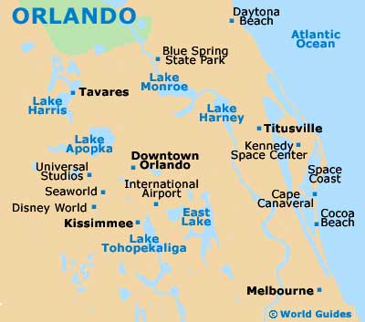
The city of fun and Mickey Mouse, Orlando has become a world-class tourist destination with heaps of attractions for all the family. One of Florida's top resorts, Orlando is famous for its Walt Disney World complex, which truly is amongst the world's best theme parks, covering an area of more than 40 square miles / 104 square kilometers.
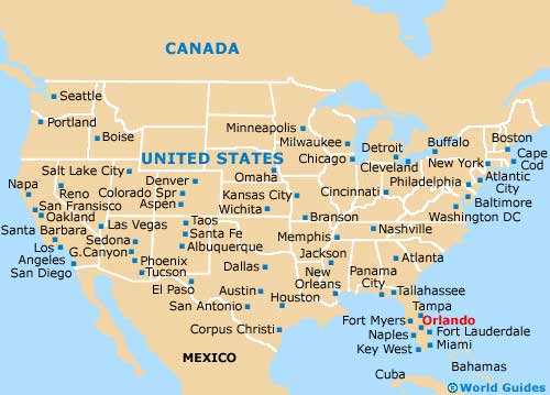
Orlando is located to the north of Kissimmee, southwest of Daytona Beach and south of Sanford, where you will find the popular Orlando Sanford Airport (SFB). In good traffic conditions, the airport can be reached in roughly 15 minutes along the I-4 interstate.
Orlando Sanford Airport (SFB) Maps: Important City Districts
The city of Sanford is overshadowed by nearby Orlando and is considerably smaller, having a population of around 50,000. Sanford is actually the local county seat and whilst its attractions hardly rival those of Orlando, the Central Florida Zoological Park is worthy of a visit.
Within the city of Orlando itself you will find everything that you could possibly need for a great vacation. Shopping centers and malls are commonplace, together with huge selections of restaurants, many of which are located along International Drive. Orlando also has its fair share of water parks and a busy downtown district, although this area is rarely on the agenda of holiday makers. Within downtown Orlando are several distinct neighborhoods, which include Eolo, Parramore and also the Uptown district.
USA Map
Florida Map

Orlando Map